The 2026 Atlantic hurricane season has been eerily quiet. As of September 23, only six tropical storms had formed over the North Atlantic, and none had intensified into hurricanes — a first since satellites began tracking storms in 1966, according to the US National Oceanic and Atmospheric Administration (NOAA). "In the satellite era, we have never had a year without a hurricane," said Matthew Rosencrans, lead hurricane season forecaster with NOAA's Climate Prediction Center. "This would be a first."
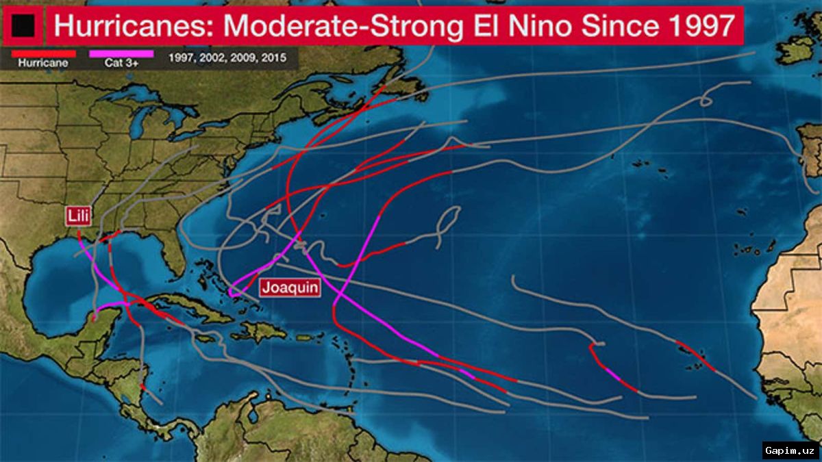
That's due in large part to the latest iteration of the El Nino-Southern Oscillation (ENSO), a shifting cycle of winds and sea surface temperatures over the Pacific Ocean that shapes weather worldwide and makes it a "dominant factor in total hurricane season activity." Meteorologists have said this year's El Nino could be one of the strongest on record. NOAA's Climate Prediction Center said the accumulated cyclone energy of this year's tropical storms — a calculation that factors in storm duration and intensity — was at a record low for so late in the season, which typically peaks on September 10.
None of the six tropical storms registered so far have reached a wind speed of at least 119 kilometers per hour (74 miles per hour) — strong enough to be considered a Category 1 hurricane. NOAA's latest data showed that El Nino is still strengthening, with sea surface temperature rise in the key Pacific region now exceeding 3 degrees Celsius (5.4 Fahrenheit), creating a "very strong" El Nino over the next half year — and a "below-normal" hurricane season.
During El Nino, the regular trade winds moving east-west across the Pacific weaken and sometimes even reverse. The changes in wind and humidity shift the jet stream, the strong winds in the upper atmosphere — and disrupt storm formation in the Atlantic. NOAA's Climate Prediction Center said any hurricanes that do appear in an El Nino year tend to form along the US East Coast and near the Gulf of Mexico, giving them less time to turn into major hurricanes — but also leaving coastal communities with less time to prepare.
A strong El Nino will weaken monsoon winds over the Indian subcontinent, often triggering severe drought. It also generally corresponds with a less active tropical cyclone season in the Indian Ocean, said Anne-Claire Fontan, a scientific officer with the WMO's Tropical Cyclone Program. Much like in the Atlantic, increased wind shear in this region can disrupt or delay the formation of storms, which Fontan said lessened the risks for countries in eastern Africa, like Madagascar and Mozambique.
Fontan said that the especially strong El Nino effect, combined with the warming effects of climate change from burning fossil fuels, is setting the stage for unprecedented weather extremes in the months ahead. "El Nino is occurring in a warmer world, and this can amplify some of its impacts, including extreme heat, heavy rainfall and drought," she told DW. Already, some forecasters like the UK's Met Office have said the combined effects of El Nino and climate change could shatter heat records in 2027. A new report from the University of Chicago-based Climate Impact Lab has projected that extreme heat could cause nearly half a million more deaths worldwide during this El Nino period, especially in the Global South.
"We are already seeing the disruption and devastation caused by droughts and floods, and we expect these impacts to worsen as El Nino intensifies," said Celeste Saulo, head of WMO, in early September, in a stark warning for governments and humanitarian organizations.
Source: www.dw.com