A new scientific study using satellite data and neural networks estimates that the world’s net groundwater depletion is nearly 36 cubic kilometres a year. Researchers at the Khulna University of Technology in Bangladesh analysed observations from the GRACE and GRACE-Follow-On gravity satellites for 2002–2022 to produce a detailed global map of changes. The study links depletion not only to reduced rainfall but also to intensive groundwater use in irrigated agriculture; the redistribution of water mass can affect sea levels and even Earth’s rotation axis.
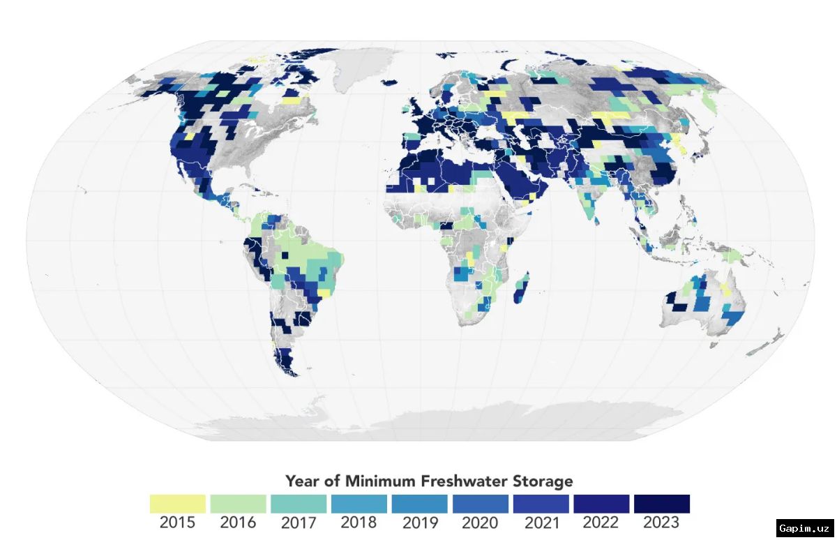
Key Takeaways: The global map covers 2002–2022 at half-degree spatial resolution. In regions where human activity and climate stress are driving rapid depletion, reserves are shrinking by an average of 358 cubic kilometres a year, while recharge elsewhere partially offsets those losses. The estimated net global decline is about 36 cubic kilometres a year.
The methodological advance lies in separating total water mass into components to isolate groundwater changes. The model accounts for precipitation, evaporation, water flow, the actual amount of atmospheric moisture available, and physical and hydrological constraints. Neural networks were trained on a dataset built around these principles, helping address a known weakness of conventional global hydrological models: they often significantly underestimate changes in the largest groundwater basins. A detailed description of the study has been published on the preprint site arXiv.org.
For each individual location, the calculations were capped by the real volume of moisture the atmosphere can supply. To test the results, the authors used data from an independent global network of monitoring wells and compared their findings with several climate models. This approach strengthens confidence in the estimates, although the authors acknowledge that broader independent observations are still needed to confirm the conclusions.
The findings matter for global water security because groundwater supports drinking water and food production for billions of people, particularly in regions dependent on irrigated farming. Shrinking reserves could increase pressure on agricultural productivity, drinking-water supplies, ecosystems and climate stability. The study therefore points to the need for wider use of satellite monitoring and physically grounded modelling in water-resource management.
In the next stage, researchers are expected to continue comparing the model with regional hydrological observations, well data and updated climate scenarios. For water policy, the central tasks are to identify the fastest-depleting areas, improve irrigation practices and assess scientifically how far groundwater aquifers can be restored.
Source: kun.uz